As construction continues on The Springs Section 1 we receive many questions concerning what everyone is seeing from CR427 as they pass by. The short answer is you aren’t seeing very much! From the south end of the lake while on the road, you are only seeing about half of the lake for a second or two heading north. If you look at the image below, you can see a side by side comparison of our marketing sheet and recent aerial photo. This image collage shows similar vantage points for reality to the left and our marketing sheet to the right.
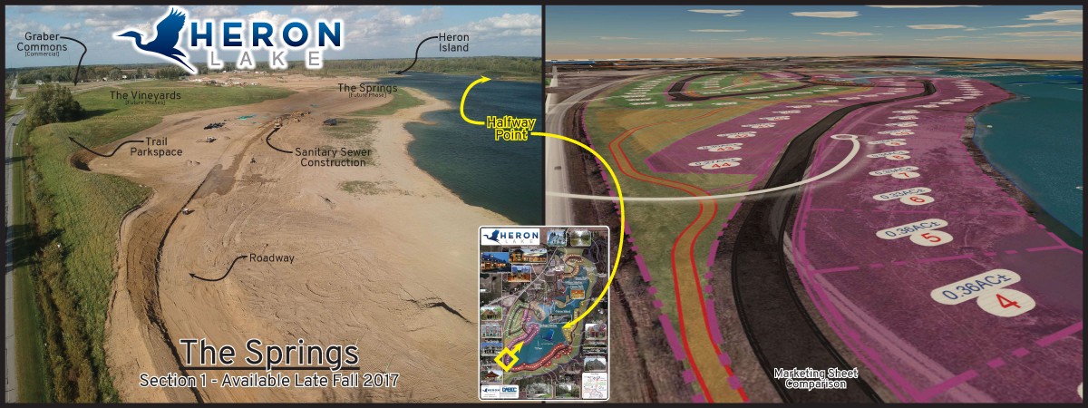
Springs construction and marketing sheet comparison
At the middle bottom of the image is small marketing sheet with photo location and orientation for reference (in yellow). Note the sanitary sewer construction (and large equipment) being performed and the halfway mark on the lake. This aerial photo still doesn’t contain all of The Spring Section 1, but gives a good example of the size of the overall site. It is quite a challenge to represent over a mile of water with a picture!
The Springs will be completed soon and we are in the final steps of completion on the Graber Commons, our first phase of commercial sites. The Heron Lake site will be supplied by City of Auburn Water and Sewer. Keep an eye out for increased activity along CR427 as we place the waterline, storm water pipes, and new entry shortly!